
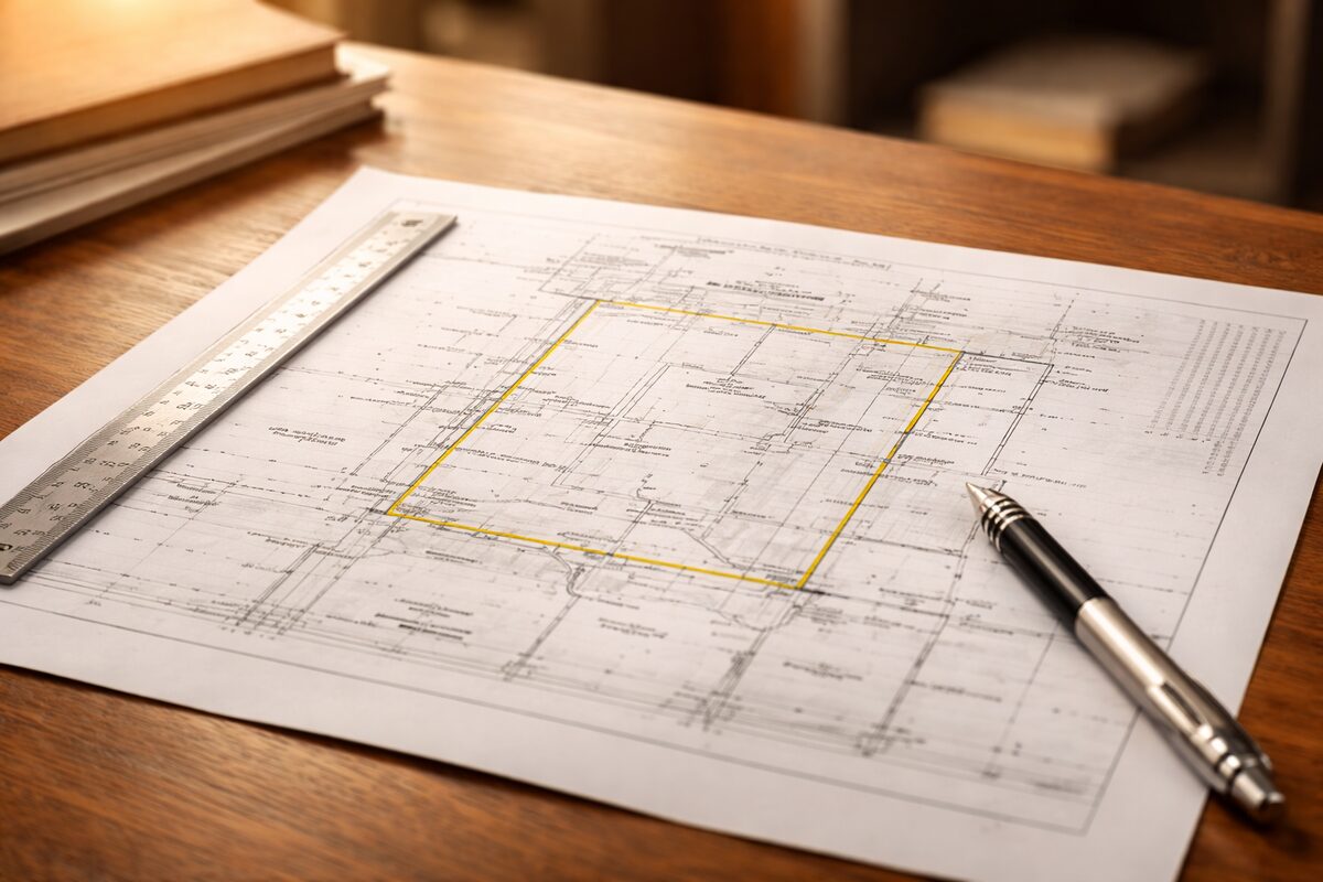
How Do You Read a Land Survey?
A land survey looks like a mess of lines, numbers, and symbols the first time you see one. But once you know what you’re looking at, it’s a straightforward document. The heavy lines are your property boundaries. The numbers tell you how long each side is and which direction it runs. Everything drawn inside the boundaries shows what’s on your property — buildings, fences, easements, driveways.
If you’re selling a home in Texas, you’ll probably encounter your survey when the title company asks for it or when the buyer’s lender requests one. Understanding what it says — and whether it’s still accurate — can save you from surprises at closing.
Table of Contents
▼The Property Boundaries
The bold or heavy lines on a survey represent your property boundaries — the legal edges of what you own. Each boundary line has two pieces of information: how long it is and which direction it goes.
Length (Distance)
Distances are measured in feet and decimal fractions. When you see 125.50’ on a boundary line, that means 125 feet and 6 inches. When you see 42.00’, that’s exactly 42 feet.
These measurements tell you the dimensions of your lot. If you’re curious whether your property is the size you think it is, the boundary measurements on the survey are the definitive answer — not your tax records, not your deed, and definitely not what your neighbor told you.
Bearing (Direction)
Bearings describe which direction a boundary line runs using compass notation. They look intimidating — N 45° 30’ 15" E — but the system is simple once you break it down:
- N = start from north (or S = start from south)
- 45° 30’ 15" = the angle, measured in degrees (°), minutes (’), and seconds (")
- E = rotate toward east (or W = toward west)
So N 45° 30’ E means: starting from north, rotate 45 degrees and 30 minutes toward the east. That’s the direction the boundary line runs.
Every bearing starts from either north or south and rotates toward either east or west. If you’re standing at one corner of your lot and looking along a boundary line, the bearing tells you which compass direction you’re looking.
In practice, you don’t need to calculate bearings yourself. The surveyor did that. What matters is that each boundary line has a unique length and direction that precisely defines where your property begins and ends.
Survey Symbols
Every survey has a legend — usually in a corner — that identifies the symbols used. But most symbols are standard across surveys. Here are the ones you’ll see most often:
Boundary Markers
- Iron pin / iron rod (●) — a physical marker driven into the ground at a property corner. The surveyor either found an existing one or set a new one.
- “Found” vs “Set” — “Found” means the surveyor located an existing marker from a previous survey. “Set” means they placed a new one. Both are legitimate boundary markers.
- Cap — a marker with the surveyor’s name, number, or company stamped on it. This identifies who placed it.
Structures
Buildings, garages, sheds, pools, and other structures appear as hatched or outlined shapes on the survey. The survey shows exactly where each structure sits on the lot and how far it is from the property boundaries. The distance between a structure and a boundary line is called a setback.
Easements
Easements appear as dashed lines or shaded strips running through the property. Common types:
- Utility easement — where power lines, water lines, gas lines, or sewer lines run. The utility company has the right to access this area.
- Drainage easement — where water is directed to flow. You can’t build structures or alter the drainage in this area.
- Access easement — a right of way for someone to cross your property to reach theirs, or for a shared driveway.
You own the land within an easement, but you can’t build permanent structures on it. If you build a shed on a utility easement, the utility company can require you to move it — at your expense.
Setback Lines
Dashed lines running parallel to the property boundaries represent building setback lines. These are set by local zoning or your subdivision’s deed restrictions. You can’t build permanent structures beyond these lines. If a survey shows your house extending past a setback line, that’s an encroachment — which can create issues at closing.
Other Common Items
- Fences — shown as thin lines, sometimes labeled with the material (wood, chain link)
- Driveways and walkways — shown as outlines
- Trees — large trees may be marked, especially if near a boundary
- Pools — shown as outlines with dimensions
- Overhead wires — sometimes marked with “OHW” labels
Easements and Encroachments
Easements
An easement gives someone other than the property owner the right to use a specific part of the land. You still own it, but your use is restricted.
The most common easements in Houston subdivisions are utility easements along the rear and sides of the lot. These are typically 5-10 feet wide. The power company, water department, or gas company can access this strip to maintain or repair their lines.
Drainage easements are also common, especially in Houston’s flat terrain where water management is a constant concern. If your property has a drainage easement, you can’t build anything that would block or redirect water flow.
Encroachments
An encroachment is when a structure crosses a boundary line or extends into an easement. Common examples:
- Your fence is 2 feet over onto the neighbor’s property
- The neighbor’s shed overhangs your property line
- Your patio extends into a utility easement
- Your roof overhang projects past the setback line
Minor encroachments — a fence a few inches off the line — are common and usually not deal-killers. The title company can often insure around them. Major encroachments — a structure built entirely in an easement, or a building that crosses a property line — are serious and can delay or kill a transaction.
If your survey shows encroachments, your broker and title company need to know about them early in the process.
Plat Map vs Survey
People confuse these. They’re related but different:
A plat map is the recorded map of an entire subdivision — all the lots, streets, common areas, and easements. It’s filed with the county when the subdivision is developed. Think of it as the neighborhood blueprint.
A survey is a detailed measurement of your specific lot — boundaries, structures, easements, and encroachments. It’s created by a licensed surveyor for your transaction.
The plat shows the neighborhood. The survey shows your property.
Why Surveys Matter When Selling
If you’re selling your home in Texas, the survey comes into play in several ways:
Title insurance. The title company uses the survey to determine what they’ll insure. Encroachments, easement violations, and boundary issues can limit or exclude coverage.
Buyer’s lender. Most lenders require a survey before funding the loan. They want to verify the property boundaries and confirm there aren’t issues that affect the property’s value.
Closing costs. If you have an existing survey that’s still accurate, you can sign a T-47 Affidavit and avoid the cost of a new one ($400-600 in Houston). If you’ve made changes to the property since the last survey — added a fence, pool, or structure — you’ll likely need a new survey.
Dispute prevention. A current, accurate survey prevents boundary disputes after closing. If the buyer discovers after moving in that the fence is actually on the neighbor’s property, and the survey would have shown it, you could be liable.
Common Survey Issues in Houston
Houston’s flat terrain, clay soil, and dense subdivisions create some common survey issues:
Fence encroachments. Fences are rarely placed exactly on the property line. A few inches off is normal and usually not a problem. A few feet off — or a fence on the wrong side of the line entirely — is a bigger issue.
Drainage easement violations. Homeowners build patios, sheds, or landscape features in drainage easements without realizing they’re restricted areas. When the survey shows the structure in the easement, it becomes a title issue.
Foundation footprint. In older Houston homes where additions were built without permits, the building footprint can extend past setback lines or into easements.
Pool encroachment. Pools installed after the original survey may encroach on easements or get closer to the property line than setbacks allow.
Your broker and title company will review the survey and flag any issues before they become closing problems.
Related Articles
Selling a Home in Houston?
1% listing fee. Full service. No long-term contract.
Frequently Asked Questions
How do you read a land survey?
Start with the property boundaries — the heavy lines on the survey. Each boundary line shows its length (in feet) and direction (in degrees). Structures, easements, and setback lines are drawn inside the boundaries.
What do the numbers on a land survey mean?
Numbers on a survey represent distances (in feet and decimals) and bearings (compass directions in degrees, minutes, and seconds). Together they define the exact location and length of each boundary line.
What is a bearing on a land survey?
A bearing describes the direction of a boundary line using compass notation. For example, N 45° 30' E means the line runs from south to north at 45 degrees and 30 minutes east of due north.
What do the symbols on a land survey mean?
Common symbols include iron pins or rods (boundary markers), dashed lines (easements or setback lines), hatched areas (structures), and circles with crosses (found survey markers). A legend on the survey identifies each symbol.
What is an easement on a land survey?
An easement is a right for someone other than the property owner to use a portion of the land — typically utilities, drainage, or access. Easements appear as dashed lines or shaded areas on the survey.
Do I need a new survey when selling my house in Texas?
Not always. If you have an existing survey and nothing has changed (no new fences, structures, or improvements), you can sign a T-47 Affidavit and reuse the existing survey. If changes have been made, a new survey is recommended.